“Of all the paths you take in life, make sure a few of them are dirt.”
-John Muir, American naturalist, author, environmental philosopher, botanist, zoologist, glaciologist, and early advocate for the preservation of wilderness in the United States.
Looming sentinel above the surrounding Chihuahuan Desert is the Guadalupe Mountains National Park in west Texas, just south of the New Mexico border. Its impressive peaks reach up to 3,000 feet above the arid featureless surrounding landscape. Unlike other national parks, there aren’t any interior roads, so there’s no “scenic” byway traversing through it; instead, one must get out the trekking poles, strap on the hiking boots, and bring plenty of water, it is a desert after all. With 86,416 acres, its immense size is overwhelming, yet there are a few day hikes easily accessible from each one of the three entrances to the park. For those who love to hike and take in the raw beauty of the natural desert environment, this national park should be on your bucket list!
Pine Springs Entrance

When we first stepped into the Visitor’s Center at Pine Springs, the rangers immediately started giving advice for hiking the Guadalupe Peak Trail, so obviously this is what most people choose to do. Yet, we’re not most people…so we opted for a few different routes.
Pinery Trail
Being late in the afternoon when we arrived at the park, just to get the lay of the land, we opted to stretch our legs and use this as a warm-up trail. Round trip, this path is less than a mile, winding around the ruins of the Pinery Station.
Access the interactive Google Map and select the camera icons to view our photos from our hike. You can even change the “Base Map” to Satellite and get a real sense of our adventure!

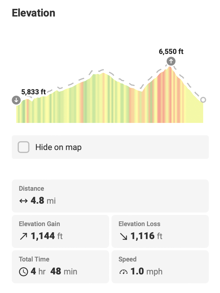
Our Hiking Stats:

Devil’s Hall and Loop Trails

The next day we ventured into the Guadalupe Mountains wilderness taking the Devil’s Hall Trail, which provided an incredible introduction to the desert environment! We were fortunate along the way to spot a number of Barbary Sheep perched atop the canyon walls. And just like humans, the “kids” were rambunctiously clambering about while the “adults” where trying to ignore them, wanting only to relax in the sun!
Barbary Sheep Overlooking Devil’s Hall / Loop Trails
This area of the country is very dry with little rain fall, so imagine our surprise while hiking we came across a single deep pool of water. Mother Nature certainly knows how to make an awesome soaking tub with built in seating! The canyon walls along the Devil’s Hall trail slowly constrict the gorge to where they are no more than 15-feet apart! Talk about a true wind tunnel!


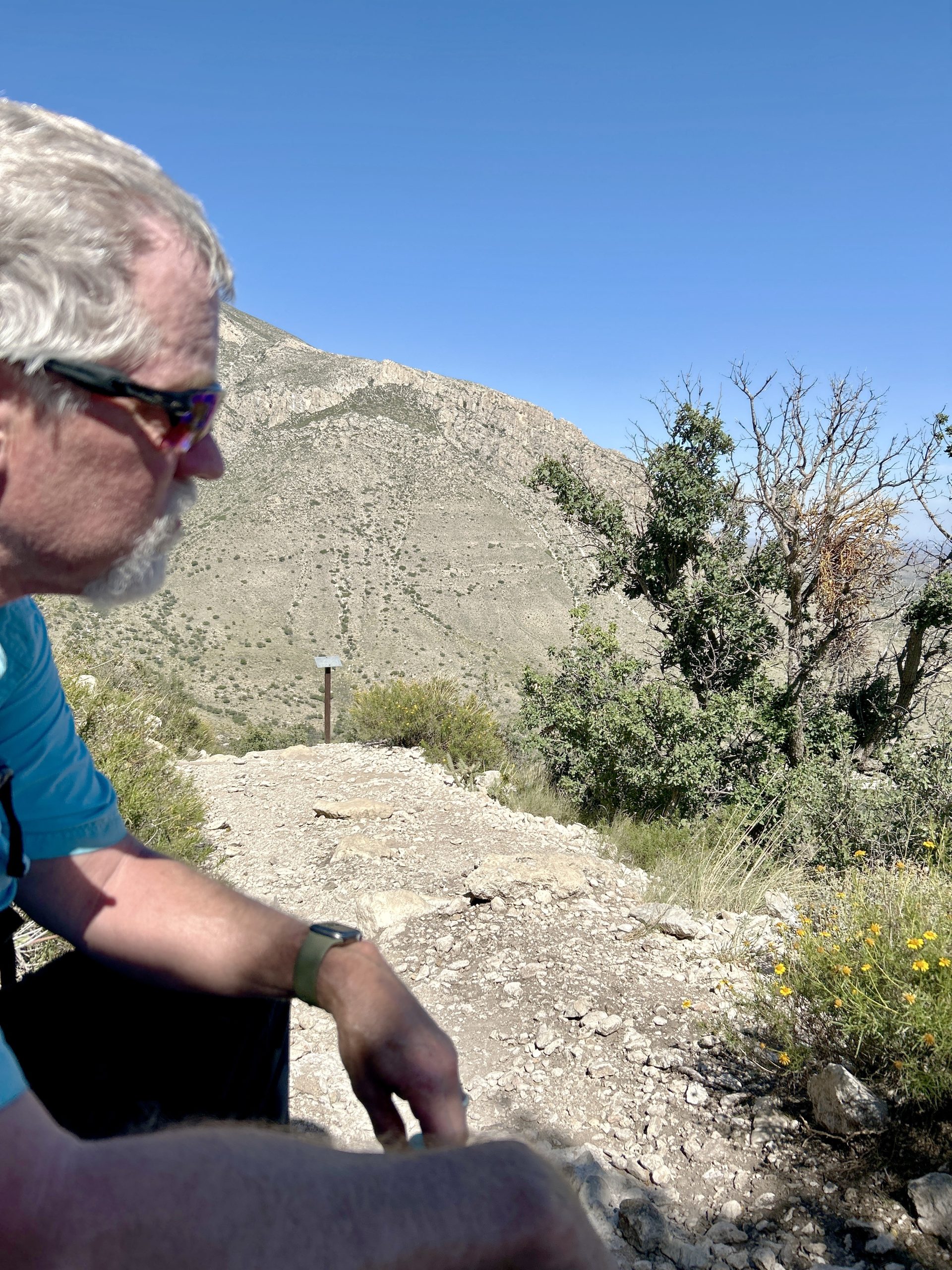
Of course, what goes up the trail, must come down, but not necessarily along the same path. Halfway down, we choose to tackle the trail that links to the lower half of the Guadalupe Peak Trail; this constitutes the Devil’s Loop portion. And we are here to tell you that it lived up to its name! The fact that the trail started with an incline should’ve been a giveaway for what was in store. Now, if we’d attempted this leg at the onset, it wouldn’t have been so wearing. However, on the backend, it was a killer! We took a well-deserved respite once we hit the Guadalupe Peak trail. Curtis’ expression below says it all about how we felt.


Luckily, it was all downhill from there, which was welcomed, yet the moderately steep grade and the well worn state of the trail meant that we couldn’t let our guard down.
All in all, the trail illustrates that treasures in the desert can be found, they just aren’t easily revealed.

Access the interactive Google Map and select the camera icons to view our photos from our hike. You can even change the “Base Map” to Satellite and get a real sense of our adventure!

Our Hiking Stats:

Frijole Ranch Entrance
About one mile northeast of the Pine Springs entrance lies the Frijole Ranch entrance, where the ranch house grounds are now an informational interpretive museum, highlighting the history and significance of this refuge in the desert.


Like many places where water is ever-present, it has nourished the chinquapin oaks to great heights, providing shade that is unique to these parts. Several springs in this harsh terrain provided life-sustaining nourishment for inhabitants from the Mescalero Apache, to supporting a few flailing ranching operations in the 1880’s. In 1906 the property was purchased by John T. Smith who then transformed it into a farmstead and ranching venture, providing for both his family and the surrounding community. It became a local hub, even touting the only swimming hole and, for a real treat costing only a nickel, they would take you on a boat “ride”.
Manzanita Trail and Smith Springs Loop
Well, we were intrigued now! So, we set off to find this purported spring where one could swim in and boat on. The driving force? Water had been a very elusive feature in our desert exploits thus far.
The easy trek to the Manzanita Spring is only a half-mile from the ranch house, with the surrounding tall grasses being the only give away that we’d arrived. We could imagine that it would make a refreshing swimming pocket, yet the “boating” component? Not so much. Nowadays, the park promotes it as a great spot for birding and viewing regional wildlife.

This whetted our whistle (pun intended!), hence, we set off to uncover the Smith Spring taking the Smith Spring Loop trail. From the Manzanita Spring, the paved path gave way to dirt leading us up the sloped toe of the mountain range, intermingling with the spring arroyo along the way. We found the spring just a little over half a mile away, hidden in a shaded oasis. We sat upon a bench that the park service had built, listening to the soft lull of the rivulet, while eating our lunch. Soon, another family joined us, and with them being from Texas, they provided a wealth of knowledge, recommending places to go, and things to do along our travels.
The remaining 1.15 miles to finish the loop was, again, an easy jaunt. We were ready for the air conditioning in the truck and the prospect of settling down to relax back at camp, fulfilled by another beautiful day’s crusade!

Access the interactive Google Map and select the camera icons to view our photos from our hike. You can even change the “Base Map” to Satellite and get a real sense of our adventure!

Our Hiking Stats:

McKittrick Canyon Entrance
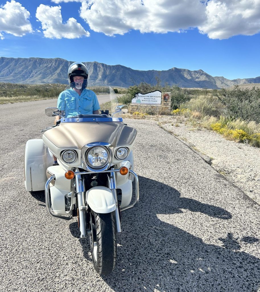
We arrived in style on our Kawasaki trike at the McKittrick Canyon entrance for our last day exploring the Guadalupe Mountains. Happily, Mother Nature was setting up another day of blue sky and sunshine! We could only hope that she’d provide a few puffy clouds too.
The name of the canyon doesn’t seem to stem from anyone of true note associated with the area, rather only a local cattle-hand. However, we soon learned that geologist Wallace Pratt left a more indelible mark upon the land.

Pratt Cabin Trail…

Prior to undertaking the Pratt Cabin Trail, we stopped in the visitor’s shelter to peruse the informational kiosks. We found a short video narrated by Wallace Pratt to be very enlightening, providing insight only a resident geologist could impart. It was a reminder that the desert floor we’d been tromping over, was actually once the bottom of the Delaware Sea about 260-265 million years ago.
Similar to all the other trails we’d been on, much of it is intertwined with the mostly dry riverbed. Here and there, we were lucky enough to encounter running water (we’re talking only a few inches in depth), or catch the trickling sounds. But mostly, the stream performed a disappearing act, with only the park service’s rock borders leading us in the right direction.
Just over two miles into the trail, we encountered the cutoff to the Pratt Cabin, situated at the confluence of the north and south forks of McKittrick Canyon. It’s a handsomely built limestone abode with a tranquil back porch view that invited us to rest up for a while before charging ahead on the next leg of our journey. It was easy to imagine why one would want to call this place home, even in such a stark environment.

…Continuing on to the Grotto and the Hunter Line Shack
One of the points made by Wallace Pratt in the video we’d watched, was that along our journey the territory would transition from a desert environment to one that is nurtured by a more riparian environment. With the sun beating down sans clouds, we welcomed the shade that dappled this habitat. A draw for fall hikers are the maple trees whose leaves are infamous for their brilliant seasonal color. We, of course, were hoping to be lucky enough to witness this. Unfortunately, with the days still reaching temperatures into the 80’s, the trees hadn’t gotten the hint yet. On the other hand, this meant that we weren’t experiencing the crowds that can flock for leaf peeping, which was good, since we already had the volume that a Columbus Day / Indigenous People’s Day holiday weekend already bestowed.

Ultimately, we came upon The Grotto just over 3-miles up. Its not only distinctive because of it’s appearance, its unique because as we approached, we began to sense cooler air emanating from the yet unseen hollow; it was a natural refrigerant to linger near while inspecting the stalactite and stalagmite remnants of the ancient underwater environment.
Our stop was brief, as we weren’t quite finished. The Hunter Line Shack was only a stone’s throw further, which would mark the terminus of our route. Just in time, as lunch was long overdue!

The shade lured us back to the grotto area where the park service has built picnic tables and benches out of the surrounding limestone blocks and slate slabs.

Fueled up and rested we set out for the 3.5-mile journey back. We opened our stride taking advantage of the gentle downhill ascent, ready to return to camp.
Access the interactive Google Map and select the camera icons to view our photos from our hike. You can even change the “Base Map” to Satellite and get a real sense of our adventure!

Our Hiking Stats:

For more photos of our adventures in the Guadalupe Mountains!
As we mounted our “horse” to leave the Guadalupe Mountains behind, there was only one song running through our heads…Sing along with us!

“You see I’ve been through the desert on a horse with no name
–A Horse with No Name, by America, a folk rock band. Song released in 1971
It felt good to be out of the rain
In the desert you can’t remember your name
‘Cause there ain’t no one for to give you no pain
La la la la la la..”

Getting your Blogs is great, especially this one with so much history that you shared. I love reading about old west history and the people who came before us. I don’t know where you find the time to put all this information together but keep it up. When I used to go to Big Bend N.P. for work, I never had the time to do much exploring so now I get to see it through your adventures. But the one thing we did do when we were down there was go to Lajitas for dinner and the Trading Post to feed the beer drinking goat – https://www.roadsideamerica.com/story/2227. Not much else to do after spending the day in meetings or walking the road all day.
So glad you’re enjoying this! And you hit the nail on the head for why we choose this platform. Marching full force into our swiss-cheese-brain years, we knew we’d never be able to remember all the stuff and adventures we’d be exposed to. Regaling it and sharing it along the way was the only way! It’s also interesting to hear how the stories resonate with everyone so keep sharing them! Stories about Big Bend are just around the corner (as long as technology doesn’t keep stymieing us…heavy sigh…). Stay tuned!! Lots of love!!